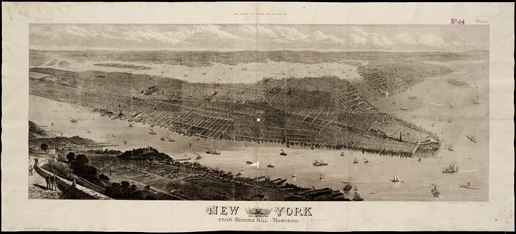
Created by T. Sulman and Robert Loudan in 1876, this vintage illustrated map shows a birds-eye view of Lower Manhattan as seen from Hoboken, New Jersey. Zooming in to the full version, you can see many pieces of the City that are still here today such as Trinity Church, Bellevue Hospital, and Union, Madison and Tomkins Square Parks.
New York : From Bergen Hill, Hoboken. Extra supplement to the Ilustrated London News, August 18, 1876. Bird's-eye view of New York, New York, showing Battery Park on the right and Central Park on the left; also visible are the foundations for the Brooklyn Bridge.
Check out the specimen page on Digital Commonwealth for more info on the map.

Matt Coneybeare
Editor in Chief
Matt enjoys exploring the City's with his partner and son. He is an avid marathon runner, and spends most of his time eating, running, and working on cool stuff.
Something wrong with this post? Let us know!


