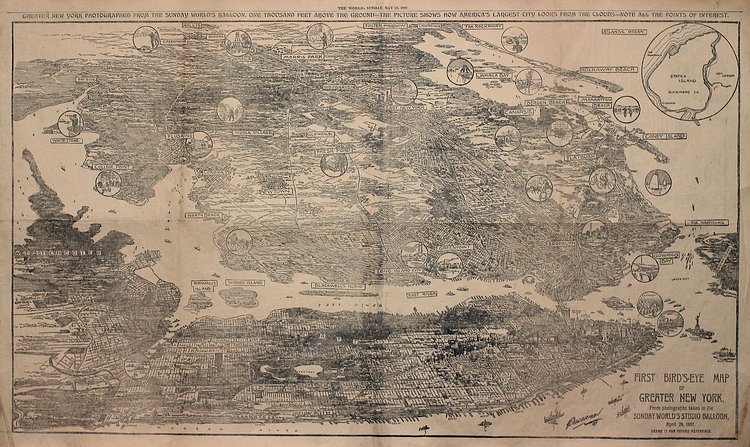
Take a peek into the infancy of aerial cartography with this unique vintage map of greater New York from 1897.
Imagined from photographs taken from balloons, the map shows landmarks, points of interests, and neighborhoods. Beyond the fascinating glimpse into 1897 New York, the piece contains even more significance:
This is our first encounter with with this early "air age" type view that actually was referencing physical vantage from above, not a conceptualized imagination of the area. While balloon views can be found centuries prior, this view might include the highest elevation and perspective on the metropolis
Check out The Old Map Gallery to see more vintage maps.
h/t r/nyc

Joshua Mu
Contributing Writer
When he is not attempting to hustle the hustlers of Central Park, Joshua enjoys exploring the depths of what New York has to offer. He one day hopes to pilot a drone without immediately crashing it.
Something wrong with this post? Let us know!


