Photo:
LOC
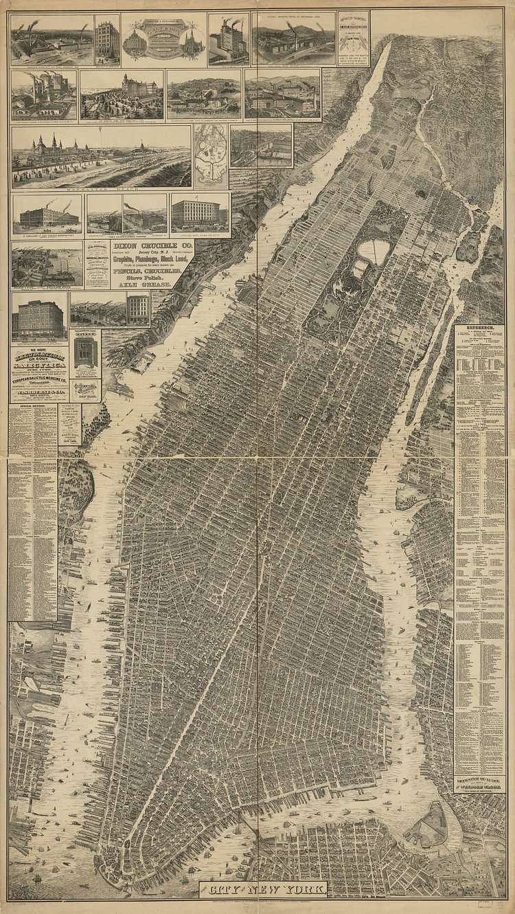
This incredible vintage map shows a detailed rendering of the the City of New York (now just Manhattan) as it appeared back in 1879. Buildings and blocks are drawn to scale, and several detail panels include closeups of important buildings at the time. Check out the Library of Congress for more details on the map.

Matt Coneybeare
Editor in Chief
Matt enjoys exploring the City's with his partner and son. He is an avid marathon runner, and spends most of his time eating, running, and working on cool stuff.
Something wrong with this post? Let us know!


