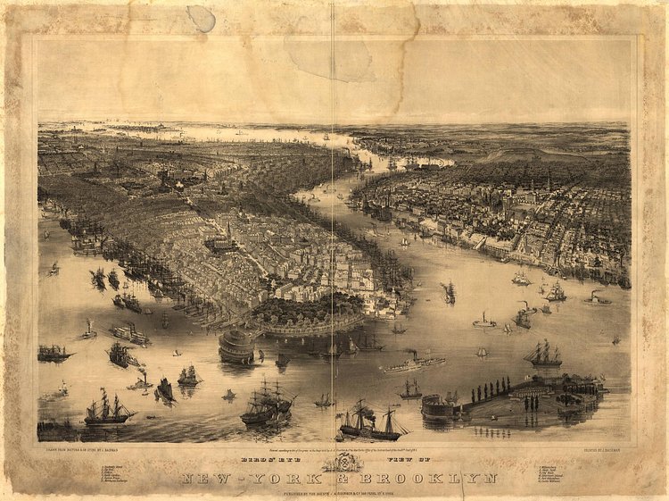
This vintage map from 1851 shows a New York and Brooklyn very different from what we know today. Much of Brooklyn is still undeveloped, including the Navy Yards, most of Williamsburg and Bushwick. Queens is almost non-existant in the distance. The famous Manhattan skylines is nowhere to be seen, and the bridges have yet to be built.
The map was drawn by famous birds-eye map illustrator John Bachmann and currently resides in the Library of Congress.
Bird's-eye view of New York City and Brooklyn showing Battery Park and Governors Island in the foreground; prominent features numbered with key below image.

Matt Coneybeare
Editor in Chief
Matt enjoys exploring the City's with his partner and son. He is an avid marathon runner, and spends most of his time eating, running, and working on cool stuff.
Something wrong with this post? Let us know!


