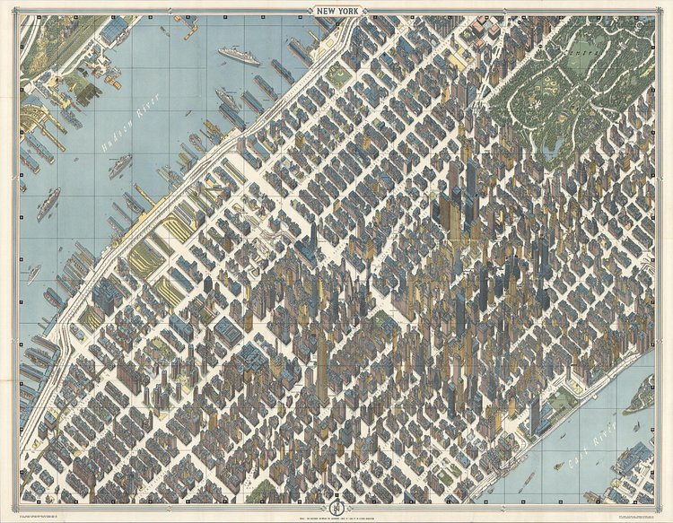
This hand illustrated birds eye view map of Midtown Manhattan was created by cartographer Hermann Bollmann for the 1964 New York World's Fair in Queens.
One of the greatest cartographic feats of all time, this 1963 axonometric ('bird's eye view') map of New York City was the first such since 1866. The technique dates back to the 15th century, and developed in Germany into a fully flowered cartographic art form called Vogelschaukarten in Germany in the 1800s. This particular map was prepared by Herman Bollmann for the 1964 New York World's Fair, where it was sold at information and tourist kiosks.
Check out the accompanying article to read more about this incredible map's history.
via Geographicus

Matt Coneybeare
Editor in Chief
Matt enjoys exploring the City's with his partner and son. He is an avid marathon runner, and spends most of his time eating, running, and working on cool stuff.
Something wrong with this post? Let us know!


