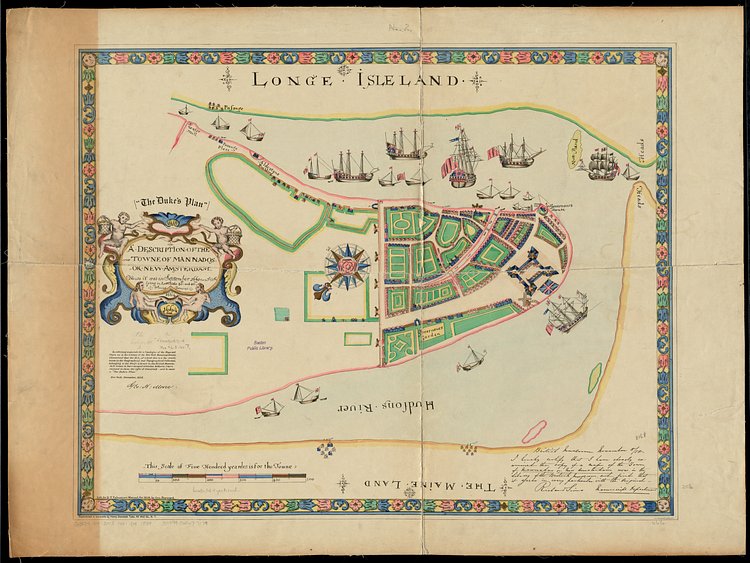
This incredible vintage map shows Lower Manhattan as it was in September of 1661. According to historian and redditor discovering_NYC:
This map was largely based on a map of New Amsterdam produced in 1660 by surveyor Jacques Cortelyou, which is known as the Castello Plan. Around 1663, a copy was brought over to England, and there draftsmen in London modified it, including British ships, and a British flag flying over Fort Amsterdam (they did not have a good grasp on the area's geography, which is why the proportions of the surrounding water and land are off). The British had been eyeing New Amsterdam for some time, and in March of 1664 King Charles II granted the territory of New Netherland to his brother, James, the Duke of York. This map was likely presented to him in honor of this, hence the name the Duke's Map (the name was first applied by George Henry Moore, a librarian with the New-York Historical Society, in 1858 when he discovered it in the archives of the British Museum). The English officially took over New Amsterdam in September 1664, and both the city and the territory were renamed New York.

Matt Coneybeare
Editor in Chief
Matt enjoys exploring the City's with his partner and son. He is an avid marathon runner, and spends most of his time eating, running, and working on cool stuff.
Something wrong with this post? Let us know!


