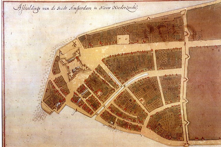
This vintage map is the Castello Plan, one of the earliest known city maps of New Amsterdam, the Dutch colony that would eventually grow into New York City. The City at that time ended with a long wall which is the namesake for the modern Wall Street. According to the New York Public Library,
The Castello plan is the earliest known plan of New Amsterdam, and the only one dating from the Dutch period. This drawing and the Manatus map of the island reproduced earlier are among the most important topographical documents that have survived from the period of the Dutch rule of New York.

Matt Coneybeare
Editor in Chief
Matt enjoys exploring the City's with his partner and son. He is an avid marathon runner, and spends most of his time eating, running, and working on cool stuff.
Something wrong with this post? Let us know!


