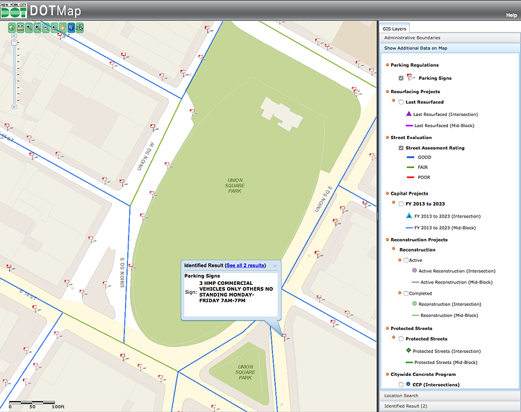
The New York City Department of Transportation has a highly-detailed interactive map showing the road quality, full text on street signs, and other interesting information about our City's roads. Check out the full map to see how your neighborhood fares.
via NYCDOT

Matt Coneybeare
Editor in Chief
Matt enjoys exploring the City's with his partner and son. He is an avid marathon runner, and spends most of his time eating, running, and working on cool stuff.
Something wrong with this post? Let us know!


