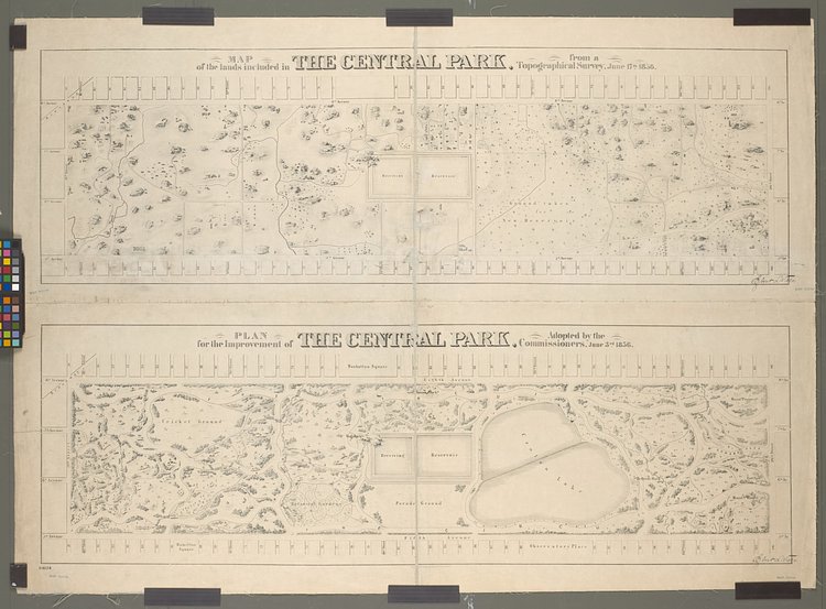
Created in 1857, Central Park is one of the most well-known parks in the world. It is the busiest park, with over 40 million visitors per year, and appears in countless movies and television productions. But before all of this, the land was a swampy patch of land with trees and water courses running throughout. These vintage maps show the geographical survey of the land in 1856 alongside the commissioned plan by park designers Frederick Law Olmsted and Calvert Vaux.
Originally published on May 14th, 2017


Matt Coneybeare
Editor in Chief
Matt enjoys exploring the City's with his partner and son. He is an avid marathon runner, and spends most of his time eating, running, and working on cool stuff.
Something wrong with this post? Let us know!


