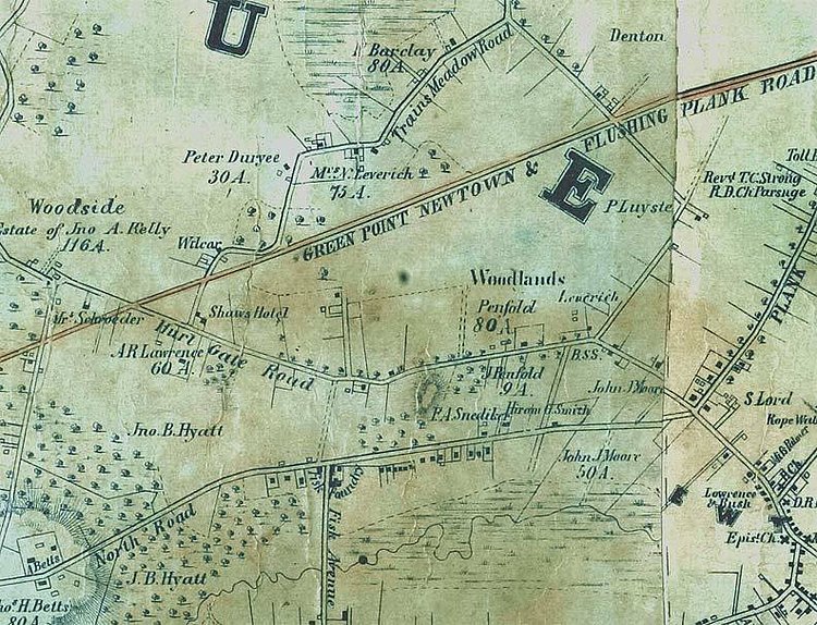
Local historical blog Forgotten NY recently dug up this great vintage map from 1852 showing the rural town of Woodside in Queens County. The accompanying article talks about how it went from farmlands to the neighborhood of the same name today.
It was first settled by Europeans in the 1640s, but remained largely rural in nature until 1869, when developer Benjamin Hitchcock purchased the estate of John A. Kelly, divided it into lots, laid out streets, and brought in other developers and industry. Kelly, for his part, had already given Woodside its name from a series of letters written from his room, which had a view of the woods out the window. The LIRR arrived in 1895, trolleys plied the main routes, and Woodside, which has somewhat nebulous boundaries (Woodside Avenue on the west, Northern Boulevard on the north, Mount Zion Cemetery and 51st Avenue on the south and the New York Connecting Railroad on the east, was folded into Queens’ overall numerical street nomenclature in the 1920s.
via Forgotten NY

Matt Coneybeare
Editor in Chief
Matt enjoys exploring the City's with his partner and son. He is an avid marathon runner, and spends most of his time eating, running, and working on cool stuff.
Something wrong with this post? Let us know!


