Photo:
MCNY
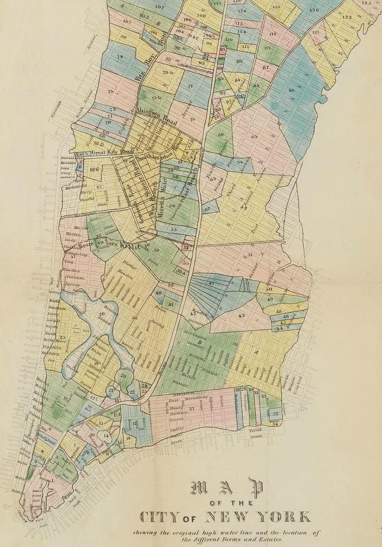
This vintage map from the permanent collection in the Museum of the City of New York dates back to 1852, but shows an overlay of pre-grid plots of land and farms. The faint black lines show the Manhattan grid, established in 1811, and the colored sections show the plots of land before the grid along with the original high water line of the island before landfill and construction extended Manhattan in all directions.

Matt Coneybeare
Editor in Chief
Matt enjoys exploring the City's with his partner and son. He is an avid marathon runner, and spends most of his time eating, running, and working on cool stuff.
Something wrong with this post? Let us know!


