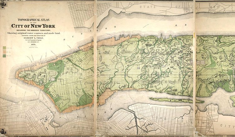
The New York Times recently published a great article titled Tracing the Waterways Beneath the Sidewalks of New York that included this great vintage map showing the original water courses that lie beneath Lower Manhattan.
In 1865, Col. Egbert L. Viele, a West Point graduate who served as the chief engineer for Central and Prospect Parks, charted every existing waterway in Manhattan, and laid the map across the street grid. It records a city that had not yet been topographically reshaped to make room for its explosive growth in the second half of the 19th century; today, very little of those waterways can be seen without intrepid exploration in sewer lines.
Check out the accompanying article for more.
via New York Times

Matt Coneybeare
Editor in Chief
Matt enjoys exploring the City's with his partner and son. He is an avid marathon runner, and spends most of his time eating, running, and working on cool stuff.
Something wrong with this post? Let us know!


