Here are the NYC Neighborhoods With the Highest Number of Dogs Per Capita

Dog Walk
Dog Walk

A recent report from the New York City Economic Development Corporation (EDC) calculated the number of licensed dogs per resident in New York City zip codes and found the neighborhoods with the highest density of dogs in the City. Coming in at the top stop is a 5-block wide zip code in Long Island City, the one that includes the waterfront highrises of Hunters Point.

The zip code, although encompassing the small area of luxury towers, restaurants, and shops between 49th Avenue up to N Basin Road and going up through Center Boulevard and parts of 5th Street, has a population of 4,702 people, according to the U.S. Census Bureau. But also within the zip code are 180 licensed dogs—or about one dog for every 26 people.

New York City Licensed Dog Population by Zip Code
Photo: NYCEDC

The next nine neighborhoods with the highest number of dogs per capita are all on Manhattan's west side, covering all neighborhoods from Battery Park City to the Upper West Side.

Check out the full report for more information on New York City's doggy density.
[WATCH] Learn All About U Thant Island, the Smallest Island in New York City

Sitting in the East River just south of Roosevelt Island is the smallest island in New York City: a pile of rocks called U Thant Island. Officially Belmont Island, the small piece of land has been off limits to the public for decades, but Vox video producer Dean Peterson recently set out to see how close he could get, and tell the fascinating history of the island.

Most people have probably never heard of it but there is a tiny 100 by 200 foot island on the East River in New York City called U Thant Island. It’s right below Roosevelt Island and next to the United Nations headquarters and has more history per square foot than most places in Manhattan.

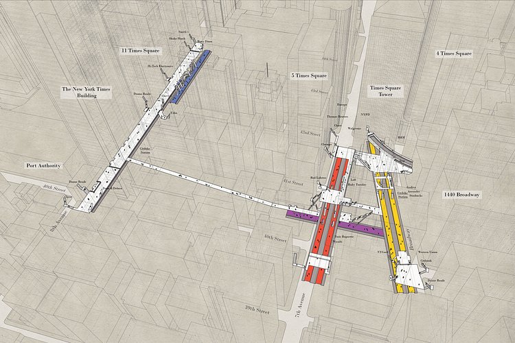
Check Out These 'X-Ray Area Maps' of New York City Subway Stations

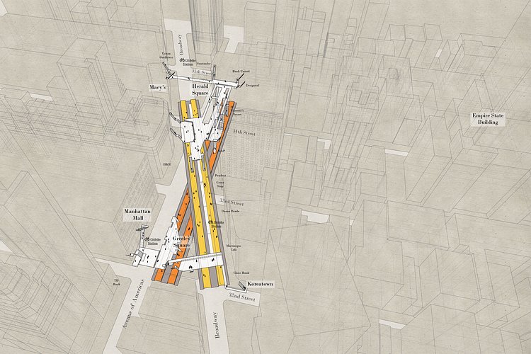
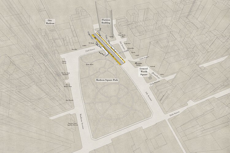
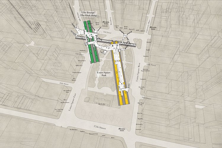
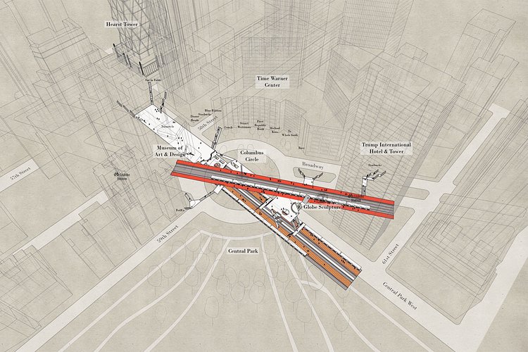
Local architect Candy Chan (previously) has another really cool map project called X-Ray Area Maps in which she is creating detailed maps of major underground New York City subway stations in relation to the building surrounding them, allowing an accurate visualization of what exactly is going on underneath the streets.

Curiously, with the overwhelming amount of information available to us today, a three-dimensional representation of the stations does not exist. I first challenged myself to document the stations simply because I thought it is something the city can use, but as the project develops, what set out to be a straightforward, mechanical exercise of surveying and drawing gradually turned into a journey of observation, discovery, and amusement.

Poster prints of these maps and more are available here. Visit the project page for more info and layouts of the City's underground subway stations.