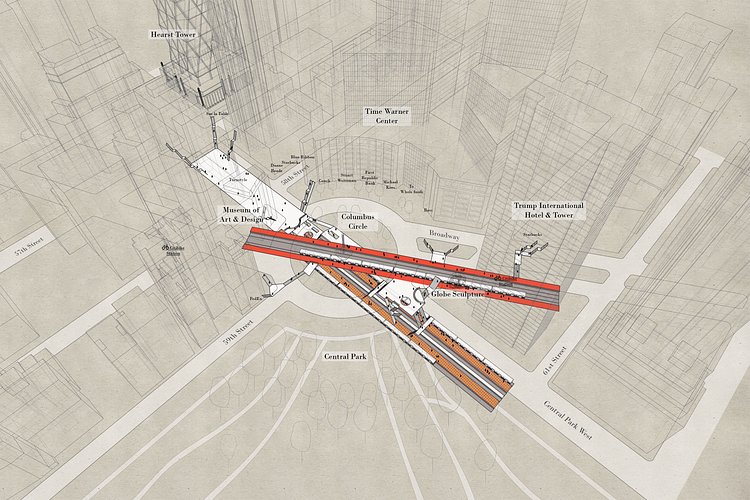
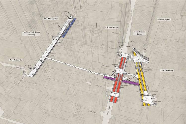
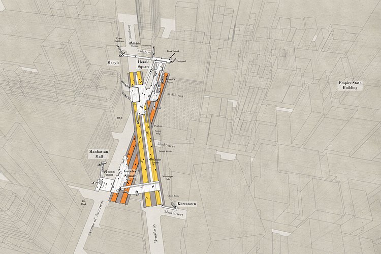
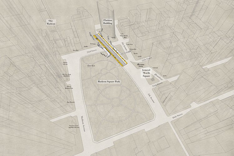
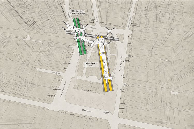


Local architect Candy Chan (previously) has another really cool map project called X-Ray Area Maps in which she is creating detailed maps of major underground New York City subway stations in relation to the building surrounding them, allowing an accurate visualization of what exactly is going on underneath the streets.
Curiously, with the overwhelming amount of information available to us today, a three-dimensional representation of the stations does not exist. I first challenged myself to document the stations simply because I thought it is something the city can use, but as the project develops, what set out to be a straightforward, mechanical exercise of surveying and drawing gradually turned into a journey of observation, discovery, and amusement.
Poster prints of these maps and more are available here. Visit the project page for more info and layouts of the City's underground subway stations.

Matt Coneybeare
Editor in Chief
Matt enjoys exploring the City's with his partner and son. He is an avid marathon runner, and spends most of his time eating, running, and working on cool stuff.
Something wrong with this post? Let us know!


