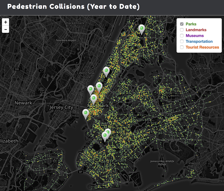
NYCROSSWALK is a new comprehensive guide and interactive site created exclusively for all pedestrians in New York City. Not only does this resource explain where, when, and how pedestrian accidents are most likely to occur but it helps tourists and residents of all five boroughs stay safer when walking around in the Big Apple.
Using the most up-to-date statistics from NYC Open Data and NHTSA FARS Database, maps and easy-to-read charts reveal the most dangerous intersections for pedestrians in Manhattan, Queens, The Bronx, Brooklyn, and Staten Island.
Visitors to the site can also see how pedestrian-related accidents have dropped since the lowered speed limit in 2014 and how NYC is getting closer to reaching the goal of Vision Zero.
Although pedestrian collisions are becoming less frequent in New York, this valuable resource lays out everything that a pedestrian needs to know from who’s most at risk for being in a pedestrian-related accident and the most dangerous time of day to walk to all the contributing factors in collisions involving a pedestrian.
Check out the interactive map to play around with the data.

Landon Biehl
Contributing Writer
Landon is an avid runner and swimmer during his free time. He enjoys writing and helping promote safety measures within communities. You can also find Landon working on his Jeep and spending time at the beach during the weekend.
Something wrong with this post? Let us know!


