Back in 2015, Brooklyn based software engineer and data visualizer Jill Hubley created an interesting project called NYC Trees that plotted all of the City's species of trees block by block in a colorful, interactive map.
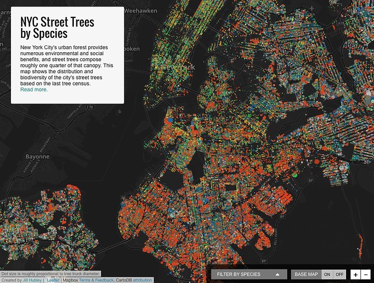
New York City's urban forest provides numerous environmental and social benefits, and street trees compose roughly one quarter of that canopy. This map shows the distribution and biodiversity of the city's street trees based on the last tree census.
To create the map Hubley aggregated data from the last NYC tree census, available on NYC's open data portal and from this past weekend's TreesCount! data jam.
For more about her process of turning the raw data into a beautiful interactive visualization tool, check out the map's accompanying article on Hubley's website.
h/t Crain's 5 Boros

Matt Coneybeare
Editor in Chief
Matt enjoys exploring the City's with his partner and son. He is an avid marathon runner, and spends most of his time eating, running, and working on cool stuff.
Something wrong with this post? Let us know!


