TreesCount! 2015 is a collaborative mapping project from the City's Department of Parks & Recreation in which they are trying to map every street tree in the City.
Our street trees work hard every day to make our city cooler, our air cleaner, and our neighborhoods more beautiful. TreesCount! 2015 is New York City’s third decadal effort to inventory, understand and better manage our urban forest. And we need tree-loving citizens to help us make trees count!
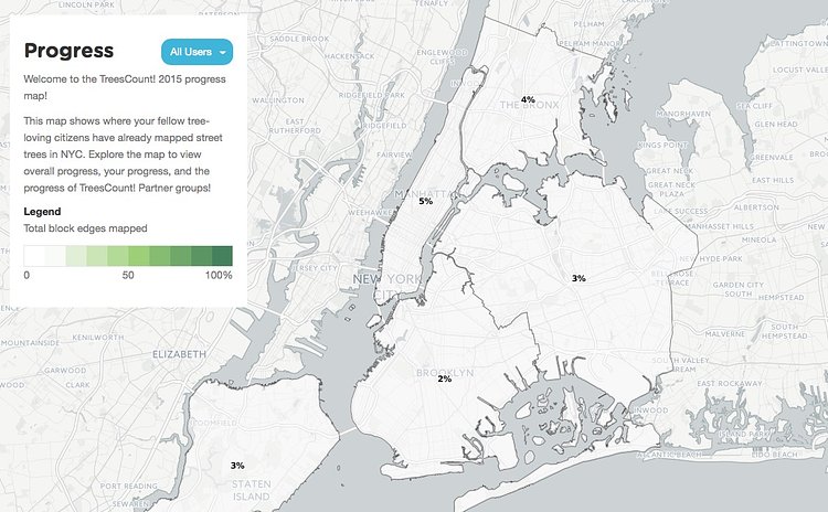
Thus far, contributors have counted fewer than 5% of all trees, so there is quite a ways to go to get an accurate picture of our urban tree-scape.
Anybody can create an account and help add data to become what department calls a "volun*tree*r."

Matt Coneybeare
Editor in Chief
Matt enjoys exploring the City's with his partner and son. He is an avid marathon runner, and spends most of his time eating, running, and working on cool stuff.
Something wrong with this post? Let us know!


