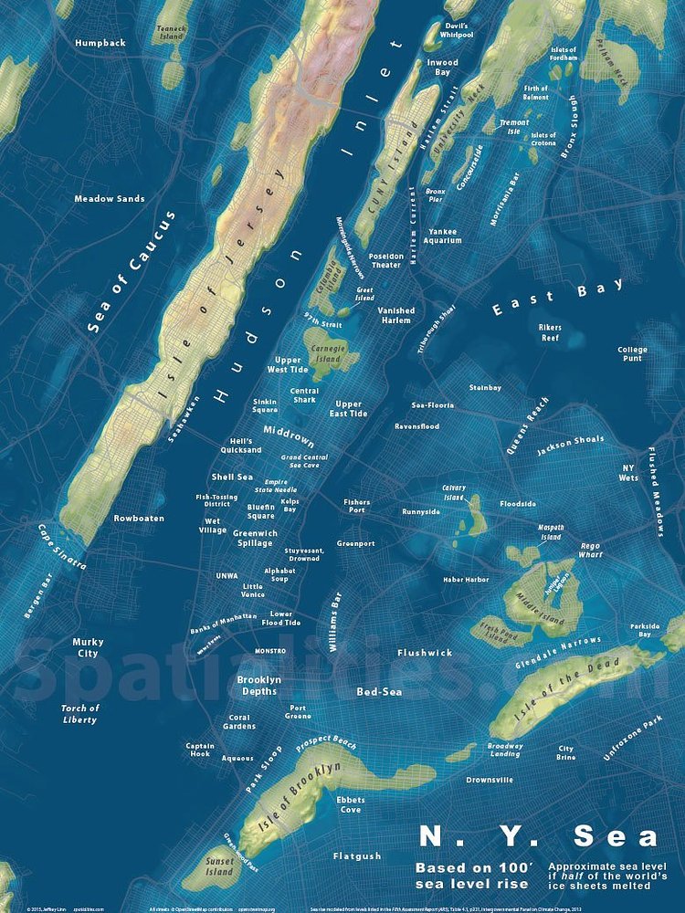
Spatialities is a blog that creates maps of well known areas as they would look under varying amounts of rising sea water. Scientists around the globe have concluded that the Earth's ocean levels are rising faster than ever before and this is a great way to visualize that in order to spur global climate policy change. The 100' level however, is probably a millennia away so no need to get your goggles out just yet.
This map features a humorous re-naming of the City's neighborhoods, but you can get the map without place names if you don't want to hear about Coral Gardens or the Upper West Tide.
via Spatialities

Matt Coneybeare
Editor in Chief
Matt enjoys exploring the City's with his partner and son. He is an avid marathon runner, and spends most of his time eating, running, and working on cool stuff.
Something wrong with this post? Let us know!


