Data science and visualization firm Landscape Metrics recently created this great interactive project called Advancing Waters which tracks the physical toll of sea level rise across New York City's five boroughs.
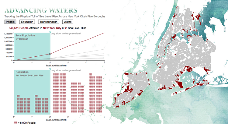
Previous sea level rise maps have shown the areas of cities that could be underwater in the future. However, our visualization goes one step further by providing information on what occupies those areas. Our project tracks the number of people, schools, transportation facilities, and waste treatment facilities that would be inundated by a sea level increase of up to 5 feet. Advancing Waters represents the beginning of a larger study examining sea level rise and coastal vulnerability.
Check out the interactive project to play with the map.
via City Lab

Matt Coneybeare
Editor in Chief
Matt enjoys exploring the City's with his partner and son. He is an avid marathon runner, and spends most of his time eating, running, and working on cool stuff.
Something wrong with this post? Let us know!


