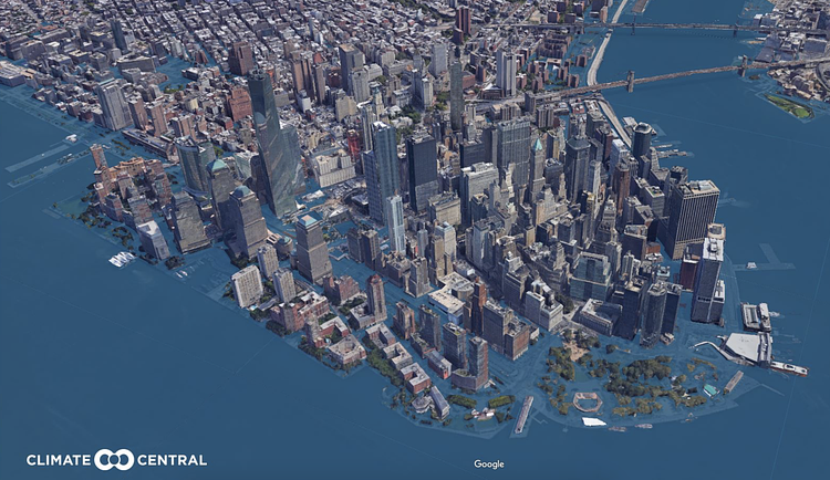
Non-profit environmental protection organization Climate Central recently created this interactive Google Earth plugin titled Surging Seas: EXTREME SCENARIO 2100 that allows you to scan every inch of the United States as it would appear under 8.25 inches of water.
This sea level rise KML overlay shows projected U.S. sea levels for the year 2100 under an “extreme” scenario published in NOAA Technical Report NOS CO-OPS 083, Global and Regional SLR Scenarios for the U.S. (January 2017). This scenario corresponds to rapid ice loss in West Antarctica this century. Recent research finds that such loss is plausible, but we do not yet know its likelihood. However, NOAA’s projections indicate that deep cuts in heat-trapping pollution could lower the chances of this scenario occurring by half.
It's a bit complicated to get setup, but once you follow their step-by-step instructions and have it running in your own copy of Google Earth, it's a terrifying glimpse at what would happen to our coastal City in the worst case scenario.
via Climate Central

Matt Coneybeare
Editor in Chief
Matt enjoys exploring the City's with his partner and son. He is an avid marathon runner, and spends most of his time eating, running, and working on cool stuff.
Something wrong with this post? Let us know!


