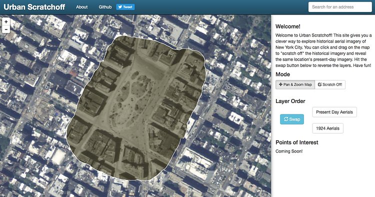
Urban Scratchoff is an interactive map of the City that lets you "scratch off" pieces of modern day map to view vintage aerial photographs of the same are circa 1924.
This site gives you a clever way to explore historical aerial imagery of New York City. You can click and drag on the map to "scratch off" the historical imagery and reveal the same location's present-day imagery. Hit the swap button below to reverse the layers.
Play with the full map to see what your neighborhood looked like in 1924.
via 6sqft

Matt Coneybeare
Editor in Chief
Matt enjoys exploring the City's with his partner and son. He is an avid marathon runner, and spends most of his time eating, running, and working on cool stuff.
Something wrong with this post? Let us know!


