Photo:
NYPL
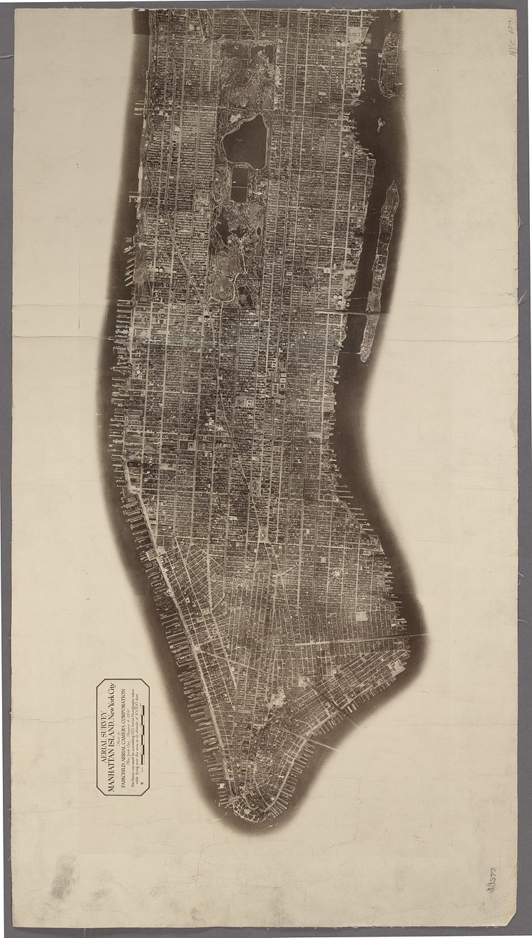
This incredible vintage photographic map gives an aerial survey of Manhattan as it appeared in 1921.
Aerial Survey. Manhattan Island, New York City. Made by Fairchild Aerial Camera Corporation. August 4, 1921.
Check out the specimen page at the New York Public Library digital collection for more information on this incredible map.

Matt Coneybeare
Editor in Chief
Matt enjoys exploring the City's with his partner and son. He is an avid marathon runner, and spends most of his time eating, running, and working on cool stuff.
Something wrong with this post? Let us know!

