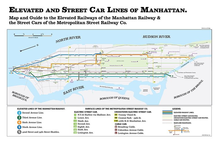
Created by vintage-map recreation artists Fifty-Three Studios, this unique map shows how Manhattan transit looked in 1899, before the introduction of the subway changed everything.
In 1899, Manhattan was dirty, overcrowded, and booming as immigrants flooded the shores of the New World looking to start a better life. The electric trolley had been recently invented, but its superiority over the older manual cable car, which you can still see in San Francisco, wasn't apparent yet. The elevated railroads, so key to the city's expansion, had not yet been converted to electric operation. In this map, the NYC transit system looks an awful lot like it does today.
Large prints of the map are available for purchase, starting at $50.

Matt Coneybeare
Editor in Chief
Matt enjoys exploring the City's with his partner and son. He is an avid marathon runner, and spends most of his time eating, running, and working on cool stuff.
Something wrong with this post? Let us know!


