Photo:
Imgur
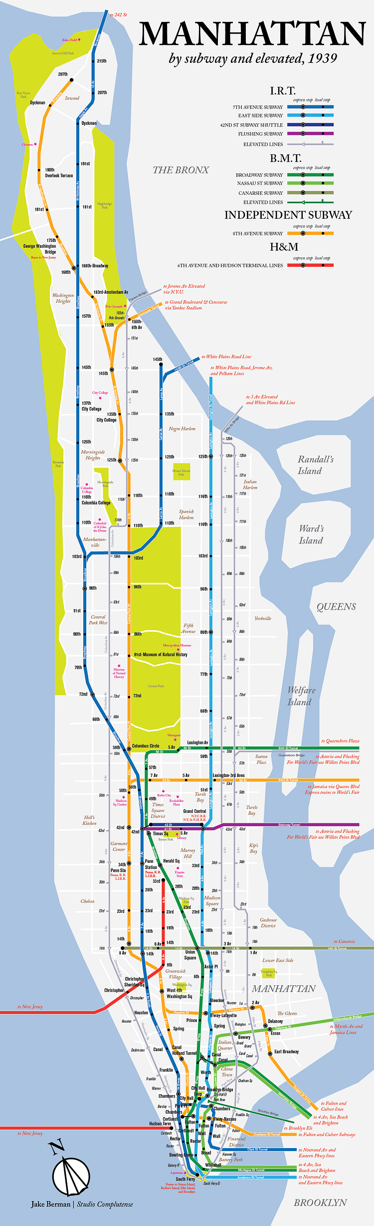
Reddit contributor and map designer Jake Berman recently made this modern map showing the subway and elevated train lines running through Manhattan as they appeared in 1939, the last year trains ran down 2nd Avenue.
In honor of the last time NYC had trains on 2nd Ave, I've made a map of the subway system in 1939.
Check out the comment thread for more insight into the map's creation.
via reddit

Matt Coneybeare
Editor in Chief
Matt enjoys exploring the City's with his partner and son. He is an avid marathon runner, and spends most of his time eating, running, and working on cool stuff.
Something wrong with this post? Let us know!


