Photo:
r/nyc
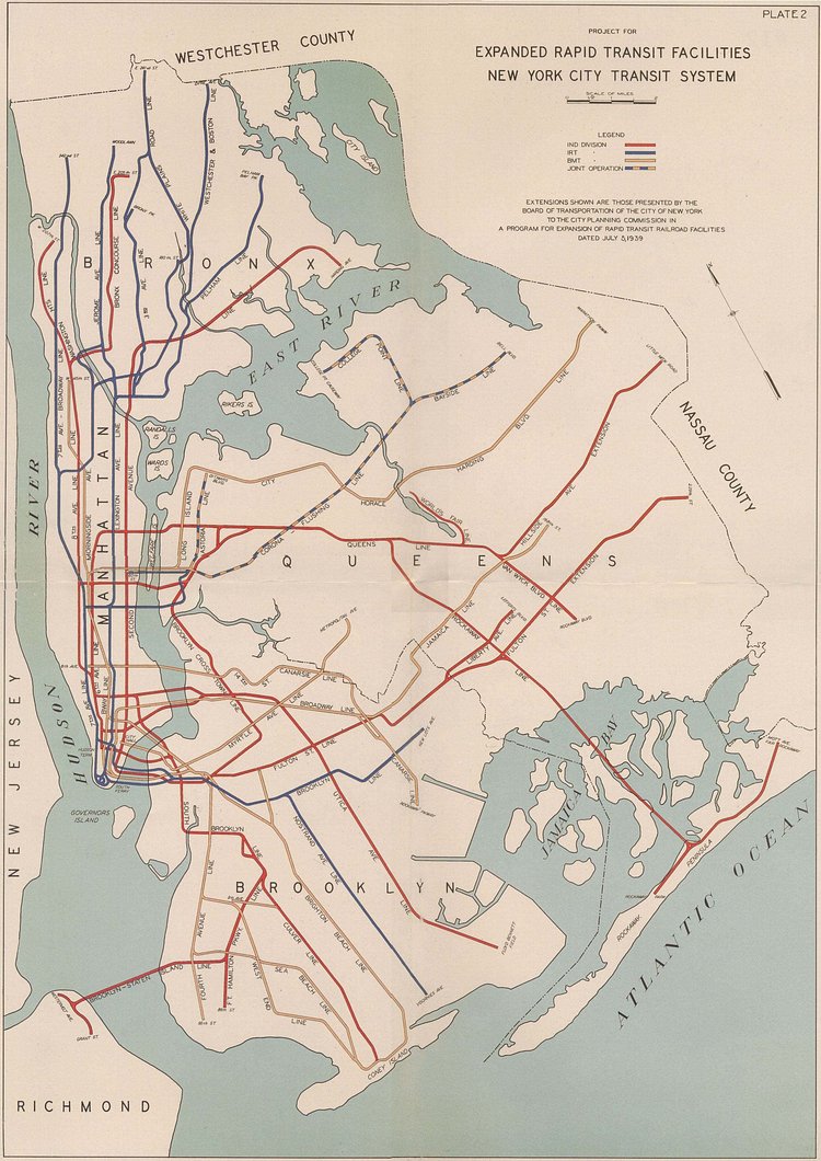
This interesting proposed transit plan from 1939 shows all 5 New York City boroughs interconnected in a way that never materialized. Check out the way the N line in Queens hits the neighborhoods of Astoria Heights, East Elmhurst, and La Guardia Airport. More surprising is how the D Line would tunnel out to Staten Island. Check it out!
via r/nyc
Originally published on April 1st, 2019

Matt Coneybeare
Editor in Chief
Matt enjoys exploring the City's with his partner and son. He is an avid marathon runner, and spends most of his time eating, running, and working on cool stuff.
Something wrong with this post? Let us know!


