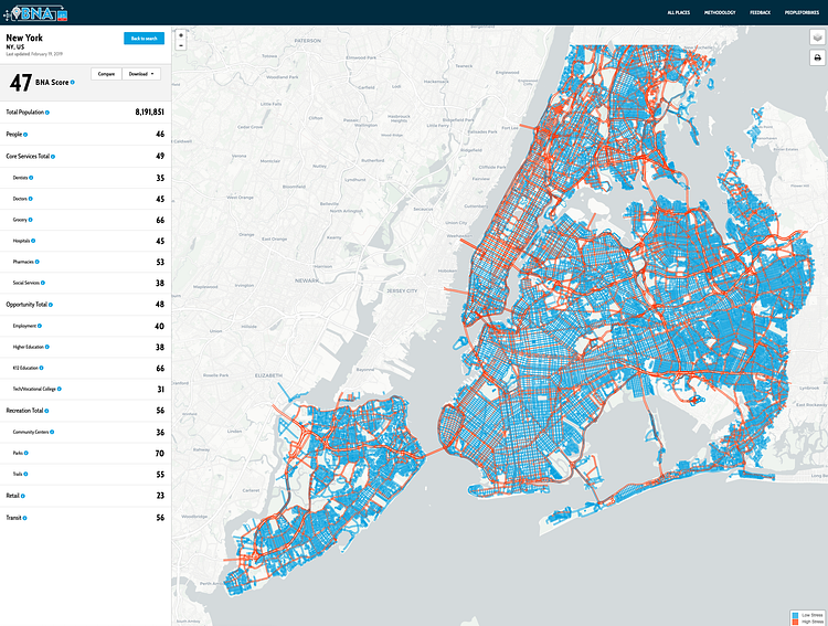
The team at PeopleForBikes have created this great interactive map called the Bike Network Analysis showing the places across the City that are the most and least stressful to ride in on a bicycle.
The project, called the “PlacesForBikes Bike Network Analysis” uses OpenStreetMap (which PeopleForBikes describes as “a sort of Wikipedia for online maps”) and methodology developed by Northeastern University’s Peter Furth. […] The networks are evaluated with a number of key destinations in mind. Bikers should be able to access residences, retail, jobs and educational services, food, health care and transit on a relatively low-stress route. “Low-stress” was an indicator developed by considering lane counts and widths, speed limits, traffic signals and parked cars along the route.
New York City is only one of 299 cities analyzed, and we score pretty low as expected. Biking in New York City is both hard and dangerous, something this project hopes to improve both here and nationwide. Play around with the full map for more.

Matt Coneybeare
Editor in Chief
Matt enjoys exploring the City's with his partner and son. He is an avid marathon runner, and spends most of his time eating, running, and working on cool stuff.
Something wrong with this post? Let us know!


