The Manhattan street grid is perhaps the most famous example of urban planning done right.
The street grid is a defining element of Manhattan. Established in 1811 to blanket the island when New York was a compact town at the southern tip, the grid was the city’s first great civic enterprise and a vision of brazen ambition. It is also a milestone in the history of city planning and sets a standard to think just as boldly about New York’s future.
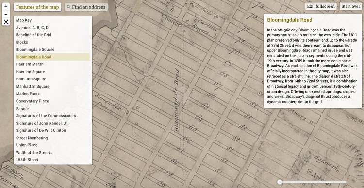
It all stemmed from the Commissioner's Plan of 1811, recently digitized and made into an interactive map called The Greatest Grid by the Museum of the City of New York.
h/t Untapped Cities via MCNY

Matt Coneybeare
Editor in Chief
Matt enjoys exploring the City's with his partner and son. He is an avid marathon runner, and spends most of his time eating, running, and working on cool stuff.
Something wrong with this post? Let us know!


