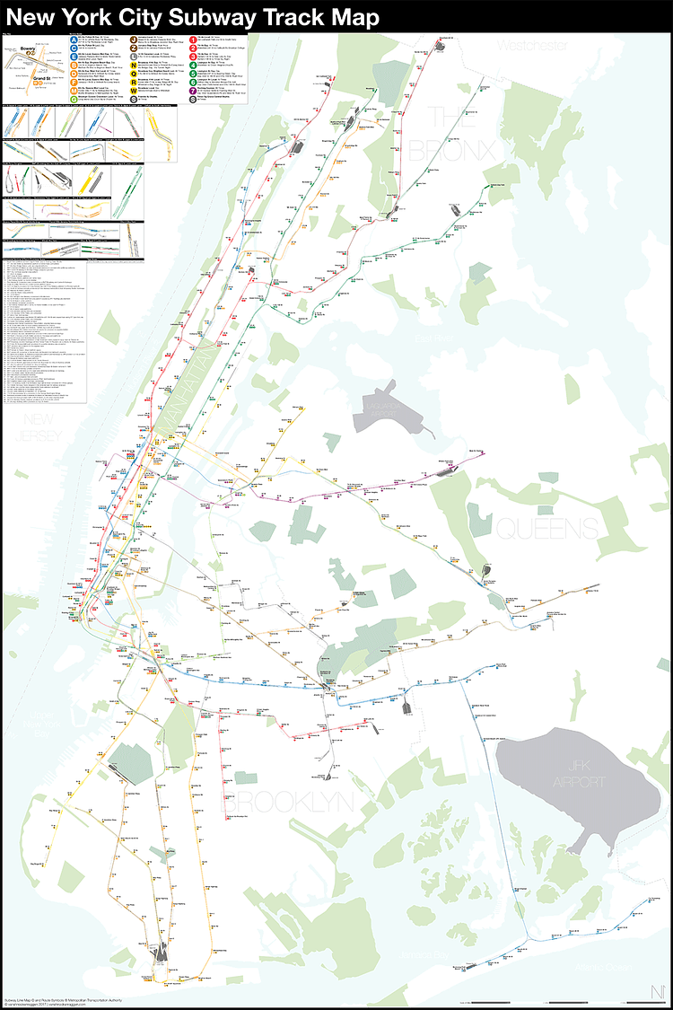
Brooklyn Cartographer Creates a Complete and Geographically Accurate NYC Subway Track Map

A Complete and Geographically Accurate NYC Subway Track Map

Local photographer and cartographer Andrew Lynch runs an interesting blog called Vanshnookenraggen (previously) in which he combines his love for the City, transportation, and maps to write great data-based articles on the City's subway system. For a recent article, Lynch created this highly detailed, fully complete, and geographically accurate map of New York City subway tracks.

To show a system map as it truly exists you need to find a track map. A track map is exactly what it sounds like, a map showing the individual tracks, crossovers, and station platforms as they really exist. Track maps are often drawn as simple schematics with straight lines for rails and boxes for station platforms. Most people would never have to use one and in fact their primary use is in control towers to display where trains are and which switches are thrown (therefore showing the route of a train). Because the control tower only needs to know where trains are and where they are going the track maps are even simpler than subway route maps.

Check out the full article for more details on the data source and methods used to create the map.
[WATCH] Meet Jeremy Levenbach, a Man Sneaking In Nude Photographs Around New York City

In this short profile video from the New York Post, meet amateur nudist Jeremy Levenbach, a man sneaking in nude photographs of himself around various public areas in New York City.

This New Yorker and Kim Kardashian have one thing in common — they love showing off their assets. Jeremy Levenbach, a 35-year-old comedy show producer, strips down in his free time to pose in a variety of locations in the city and around the globe.

Check out the Levenbutt on Instagram and Tumblr.

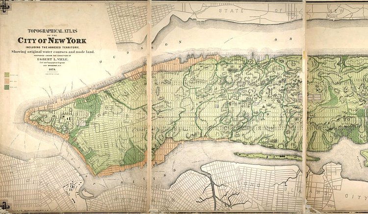
Vintage Map From 1874 Showing Manhattan's Original Natural Water Courses

 A topographical map of New York from 1874 showing original water courses.
A topographical map of New York from 1874 showing original water courses.
Photo: NYPL

The New York Times recently published a great article titled Tracing the Waterways Beneath the Sidewalks of New York that included this great vintage map showing the original water courses that lie beneath Lower Manhattan.

In 1865, Col. Egbert L. Viele, a West Point graduate who served as the chief engineer for Central and Prospect Parks, charted every existing waterway in Manhattan, and laid the map across the street grid. It records a city that had not yet been topographically reshaped to make room for its explosive growth in the second half of the 19th century; today, very little of those waterways can be seen without intrepid exploration in sewer lines.

Check out the accompanying article for more.