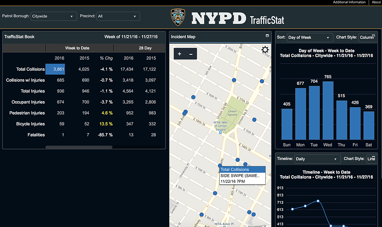
TrafficStat is a new site launched by the New York Police Department today that lets you search and display all recorded traffic collision data as recorded in the TrafficStat Book.
Most geographic coordinates are mapped to the exact location of the collision. For collisions that occur on highways, geographic coordinates are mapped to nearest mile marker. Some collision reports will not contain enough information to be geo-coded, and therefore cannot be mapped or may be mapped only to the precinct house of occurrence; but they are nonetheless included in counts. Collisions occurring in parks, beaches or open areas often cannot be mapped; some of these collisions may be mapped if there is enough information on the report to determine a close cross street and will appear on streets or intersections bordering the area. Some larger parks are bisected by streets and collisions recorded as occurring on those streets will be mapped.
On its first day released to the public, the NYPD says the data is incomplete, but will all be included in TrafficStat shortly. Check out the full map to play around with NYC's collision data.
via NYPD Online

Matt Coneybeare
Editor in Chief
Matt enjoys exploring the City's with his partner and son. He is an avid marathon runner, and spends most of his time eating, running, and working on cool stuff.
Something wrong with this post? Let us know!


