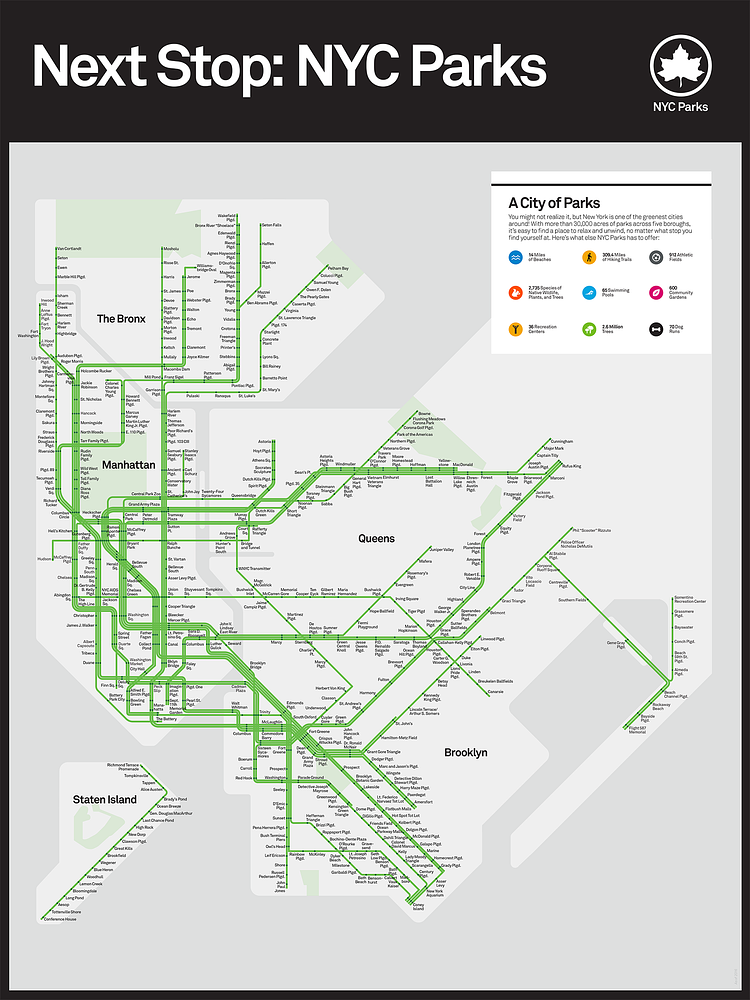
Recently released by the New York City Parks Department, this interesting map shows the City's network of public parks linked together like the MTA's NYC subway map. Because parks are not along the subway lines, a lot of artistic license was taken here, but it's a cool concept none-the-less.
With thousands of parks and playgrounds found across the city, New York City's green spaces are destinations no matter where you go. In this colorful poster based on NYC's iconic subway map, we offer you a place in the city to relax and unwind, no matter where you're going. Check out our subway-style map, and make a neighborhood park your next stop!
Check out the map page to see it larger, or to purchase one of their limited edition prints.
via NYC Parks

Matt Coneybeare
Editor in Chief
Matt enjoys exploring the City's with his partner and son. He is an avid marathon runner, and spends most of his time eating, running, and working on cool stuff.
Something wrong with this post? Let us know!


