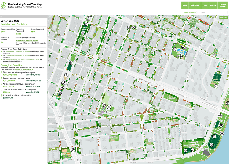
The New York City Street Tree Map is a new, interactive data visualization tool from NYC Parks that lets you explore the trees and nature on any given block in the City. Using data collected in 2015 by volunteers, and updated daily by the department's Forestry team, the maps breaks down the map by species so you can see exactly what types of trees you are looking at.
The New York City Street Tree Map is the world’s most accurate and detailed map of a city’s street trees. Through this map, you can explore our city’s urban forest, mark trees as favorites and share them with your friends, and record and share all of your caretaking and tree stewardship activities.
Check out the interactive map to play around with the data and see what trees are in your neighborhood.
via NYC Parks

Matt Coneybeare
Editor in Chief
Matt enjoys exploring the City's with his partner and son. He is an avid marathon runner, and spends most of his time eating, running, and working on cool stuff.
Something wrong with this post? Let us know!

