Photo:
LOC
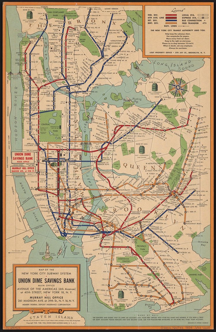
This vintage New York City subway map from 1954 shows the three separate private transit services—IND, IRT, and BMT—that would eventually combine to form the single MTA subway system we have today. The map was produced by the Union Dime Savings Bank, a financial powerhouse in the City from 1859 through the 1970s.
Check out the specimen page on the Library of Congress Digital Archives for more info on the map.

Matt Coneybeare
Editor in Chief
Matt enjoys exploring the City's with his partner and son. He is an avid marathon runner, and spends most of his time eating, running, and working on cool stuff.
Something wrong with this post? Let us know!


