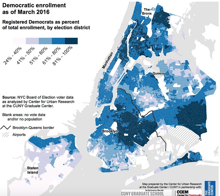
NYC Election Atlas is a joint project by CUNY's Center for Urban Research with the Graduate School of Journalism and the Center for Community and Ethnic Media that breaks down some essential election and political demographic stats for each voting district in New York City.
They recently updated some of their maps to show the voting patterns in recent primary elections and related trends across New York City in order to help provide context for the 2016 presidential primary next week.
Check out the full collection maps over on the NYC Election Atlas website.
h/t Untapped Cities

Matt Coneybeare
Editor in Chief
Matt enjoys exploring the City's with his partner and son. He is an avid marathon runner, and spends most of his time eating, running, and working on cool stuff.
Something wrong with this post? Let us know!


