Photo:
6sqft
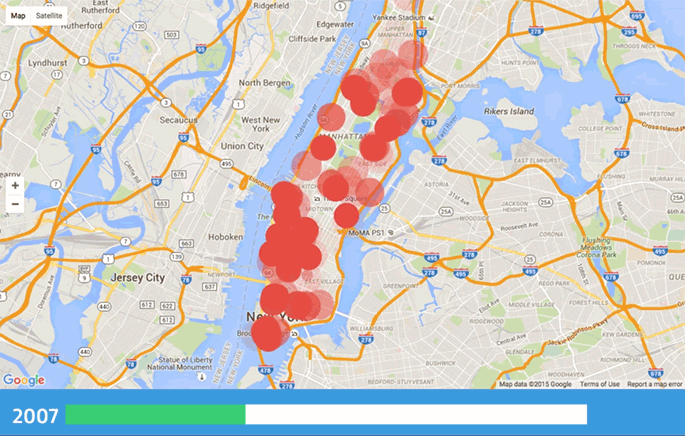
Real estate firm Address Report recently released this cool interactive map showing every building demolition in Manhattan since 2003.
The Manhattan skyline is constantly changing. We've researched every demolition to take place in Manhattan for the past 11 years and visualized it on this map. (Source: NYC Department of Buildings)
Check out the interactive map to see the data visualization for yourself.
h/t 6sqft

Matt Coneybeare
Editor in Chief
Matt enjoys exploring the City's with his partner and son. He is an avid marathon runner, and spends most of his time eating, running, and working on cool stuff.
Something wrong with this post? Let us know!


