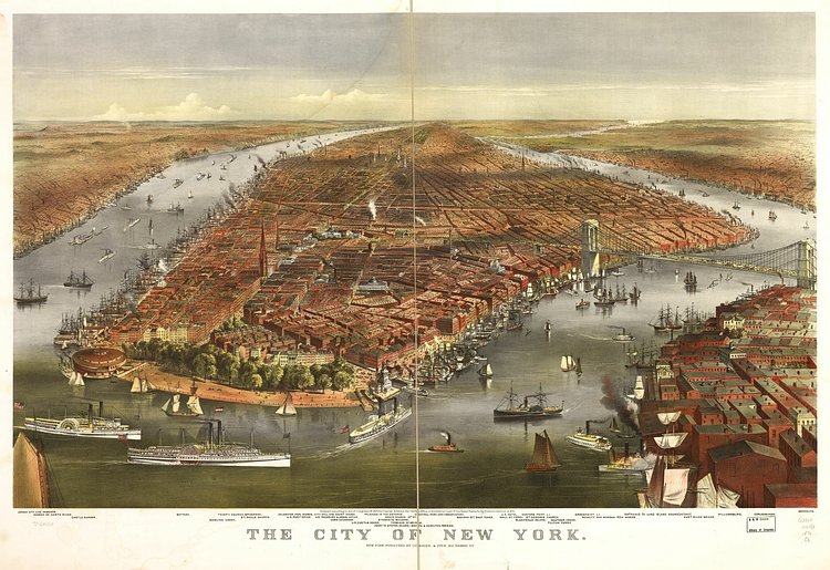
This map, created and published in 1870 by printmakers Currier & Ives, shows Manhattan, Brooklyn and bits of Queens as seen from a birds eye view over New York Harbor. Zooming in, many of the locations drawn are labeled below.
Curiously, the Brooklyn Bridge on started construction in 1870, so the artist here drew it as it would appear later. They also labeled it as the East River Bridge, presumably because it was yet to be Officially named in 1870. Also of note is how undeveloped most of Queens and The Bronx looks.
For more on the map, including larger scans and prints, check out its specimen page in the Library of Congress archives.

Matt Coneybeare
Editor in Chief
Matt enjoys exploring the City's with his partner and son. He is an avid marathon runner, and spends most of his time eating, running, and working on cool stuff.
Something wrong with this post? Let us know!


