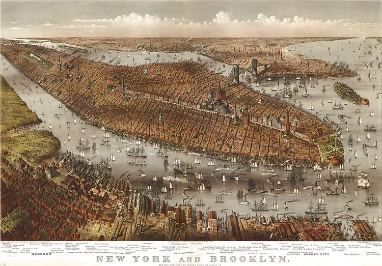
This map, created and published in 1875 by printmakers Currier & Ives, shows Manhattan, Governors Island, Brooklyn and bits of New Jersey as seen from a birds eye view over Hoboken. Zooming in, many of the locations drawn are labeled below the map.
Five years prior to this map, the same printmakers published another incredible map, similar in style but from a different angle.
For more on the map, including larger scans and prints, check out its specimen page in the Library of Congress archives.

Matt Coneybeare
Editor in Chief
Matt enjoys exploring the City's with his partner and son. He is an avid marathon runner, and spends most of his time eating, running, and working on cool stuff.
Something wrong with this post? Let us know!


