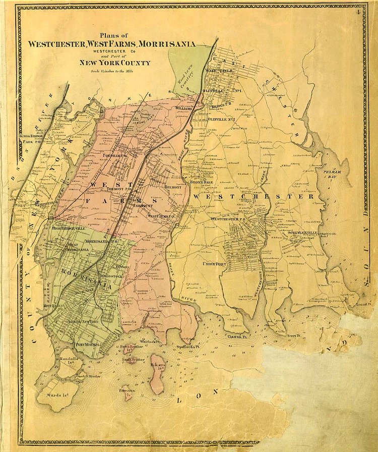
This incredible map is nearly 150 years old, dating back to 1867, 7 years prior to annexation into New York City as a borough.
The Bronx was the first area annexed to New York City—long before Staten Island, Queens, and yeah…Brooklyn. The Bronx used to be Westchester County and in fact, the county seat was right in Westchester Square in the old town of Westchester. In 1874 the Annexed District was created when the present West Bronx was incorporated into New York County. By 1895 the East Bronx was annexed as well and for 3 years New York City was comprised of Manhattan and The Bronx until in 1898 the remaining 3 boroughs were incorporated into today’s modern-day New York City. It wasn’t until 1914 that The Bronx officially became a separate county from New York and the last county created in New York State.
This photo is in the public domain in the United States. This applies to U.S. works where the copyright has expired, often because its first publication occurred prior to January 1, 1923. See this page for further explanation.
via Welcome2TheBronx

Matt Coneybeare
Editor in Chief
Matt enjoys exploring the City's with his partner and son. He is an avid marathon runner, and spends most of his time eating, running, and working on cool stuff.
Something wrong with this post? Let us know!


