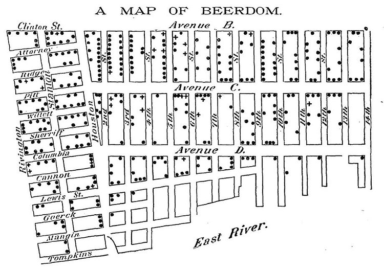
1880s Lower East Side was full of about 70,000 people, mostly immigrants, and mostly beer-loving Germans. This vintage map from 1885, appropriately titled "A Map of Beerdom", shows every place one could obtain beer or wine in the neighborhood, with many blocks having over 10 different drinking establishments.
This map was published in the Christian Union on Feb. 19, 1885. The newspaper, which was founded in 1870 by famed Brooklyn minister (and temperance advocate) Henry Ward Beecher, sent a reporter to the Lower East Side to locate saloons. The result was this “Beerdom” map, along with an article presenting some cursory findings on the social effects of the Lower East Side’s drinking culture.
Check out the full article on Slate for more analysis of the vintage map.
via Slate

Matt Coneybeare
Editor in Chief
Matt enjoys exploring the City's with his partner and son. He is an avid marathon runner, and spends most of his time eating, running, and working on cool stuff.
Something wrong with this post? Let us know!


