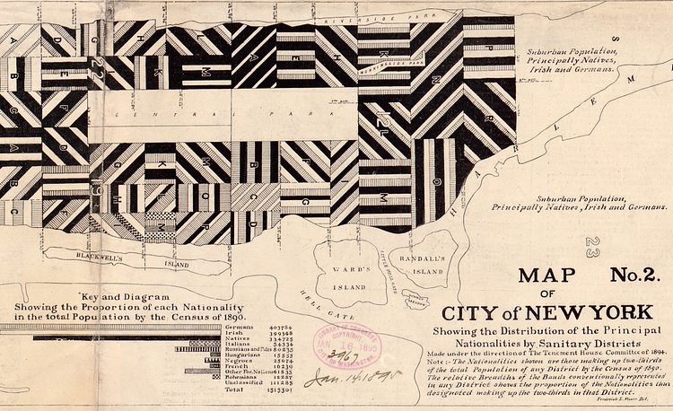
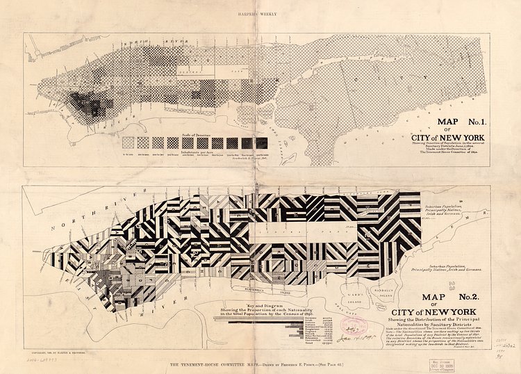
New York City is a city rich with immigrant population, and it has been this way for a very long time. In these vintage maps from 1894 recently relocated by Slate , you can see just how dense the immigrant population was in New York City, showing the distribution of the principal nationalities by sanitary districts.
These two maps don’t represent the total diversity in any given sanitation district. They only show the largest two or three groups that made up two-thirds of each district’s population. The decision ultimately dramatized the strong presence of foreign-born citizens from Germany, Ireland, Italy, and Russia throughout Manhattan. Pierce told Harpers’ Weekly at the time that Scotch, English, Welsh, Scandinavian, and Canadian New Yorkers were not recorded due to “being in small numbers and perhaps less foreign than the others.”
via 6sqft

Matt Coneybeare
Editor in Chief
Matt enjoys exploring the City's with his partner and son. He is an avid marathon runner, and spends most of his time eating, running, and working on cool stuff.
Something wrong with this post? Let us know!


