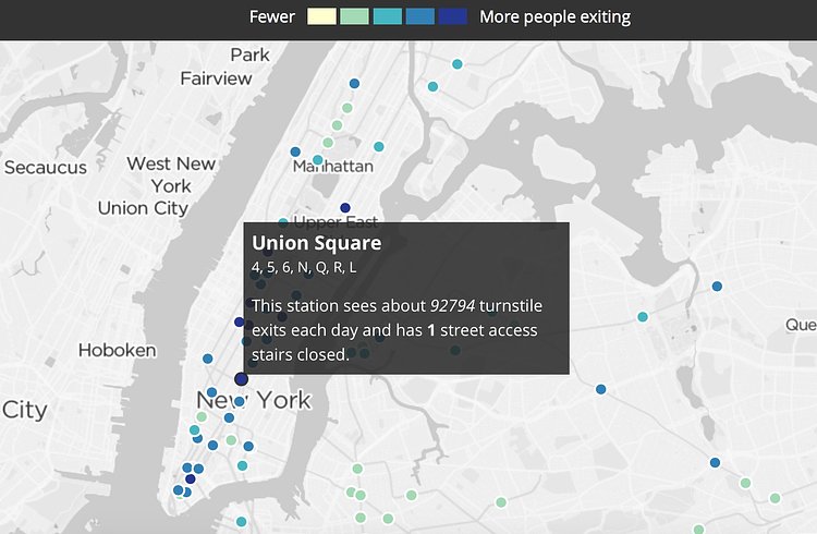
WNYC recently created this interactive map of the numerous subway entrance closures throughout the City. Our friends and transportation enthusiasts at 2nd Ave. Sagas explain why there are so many closures.
As part of the 2010 budget cuts, station agents were reduced to the point where only one station entrance requires staffing. That is, if the northbound Union St. entrance underneath 4th Ave. in Brooklyn has a station agents, the southbound entrance doesn’t need one even if the southbound platform is separated by the northbound platform by four tracks and two walls. Most stations now have (and really always have) plenty of waiting areas that aren’t visible by station agents.
Check out the interactive map, then read through the full post on 2nd Ave. Sagas for more analysis.
via 2nd Ave. Sagas

Matt Coneybeare
Editor in Chief
Matt enjoys exploring the City's with his partner and son. He is an avid marathon runner, and spends most of his time eating, running, and working on cool stuff.
Something wrong with this post? Let us know!


