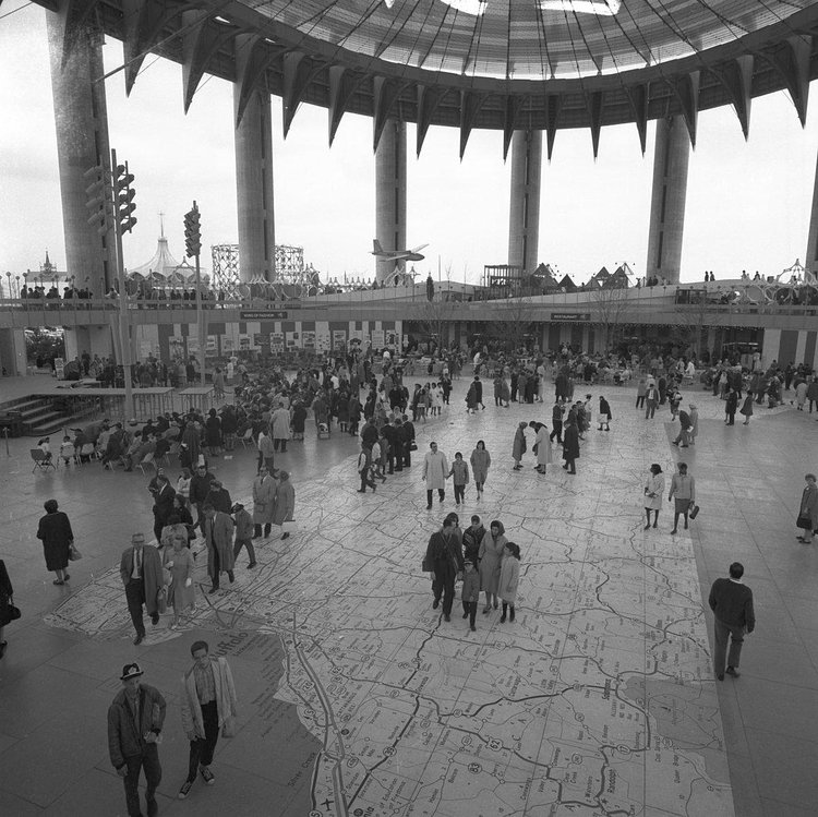
You would never know it now, but the floor of the "Tent of Tomorrow" in the New York State Pavilion at Flushing Meadows-Corona Park used to have an impressive map across the entire floor, showing the state of New York in full detail.
The Tent of Tomorrow in the New York State Pavilion from the 1964-65 World’s Fair. At what is now Flushing Meadows-Corona Park in Queens. On the floor the largest map in the world at the time, a 130-by-166-foot map of New York State.
via r/nyc


Matt Coneybeare
Editor in Chief
Matt enjoys exploring the City's with his partner and son. He is an avid marathon runner, and spends most of his time eating, running, and working on cool stuff.
Something wrong with this post? Let us know!


