Photo:
George Lewis
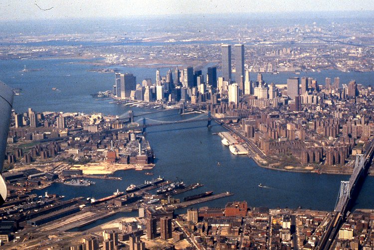
This great aerial photograph of Brooklyn and Lower Manhattan was snapped in 1981 by George Lewis from an airplane. The most notable element in the photograph is the original World Trade Center buildings towering over the rest of the skyline.
via r/nyc

Matt Coneybeare
Editor in Chief
Matt enjoys exploring the City's with his partner and son. He is an avid marathon runner, and spends most of his time eating, running, and working on cool stuff.
Something wrong with this post? Let us know!


