Photo:
Imgur
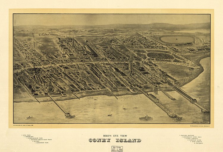
This vintage map of Coney Island from 1906 shows a fantastic aerial view of the Brooklyn neighborhood as it existed over a century ago. Of the many amusement parks that existed then, only Luna Park remains today.
Check out the Library of Congress specimen page for more info on the Coney Island map.

Matt Coneybeare
Editor in Chief
Matt enjoys exploring the City's with his partner and son. He is an avid marathon runner, and spends most of his time eating, running, and working on cool stuff.
Something wrong with this post? Let us know!


