Photo:
r/nycrail
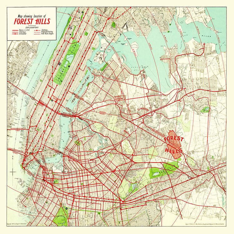
Here’s a pretty cool subway, rail, and trolley map from the early 1900’s. This particular map was commissioned by Cord Meyer, an attorney who developed a large portion of Forest Hills
via r/nycrail

Matt Coneybeare
Editor in Chief
Matt enjoys exploring the City's with his partner and son. He is an avid marathon runner, and spends most of his time eating, running, and working on cool stuff.
Something wrong with this post? Let us know!


