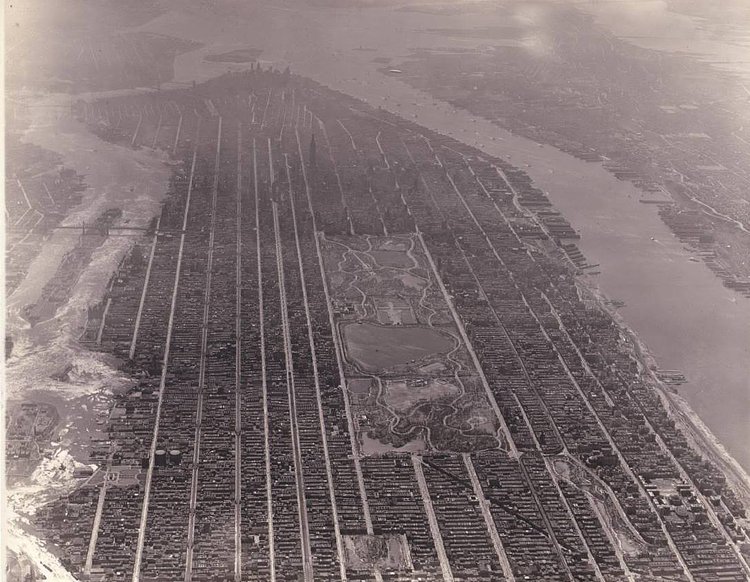
Dug up by redditor Perfect_Gas, this incredible vintage aerial photograph show Manhattan from above in 1931. The view is looking south from somewhere high above South Bronx, and and clearly shows Harlem, Central Park, the Upper East and Upper West Sides, Midtown and the Empire State Building, and lower Manhattan. Roosevelt Island (then called Welfare Island) is clearly visible in the East River, as is Governors Island, Ellis Island and Liberty Island with the Statue of Liberty standing tall.
via reddit

Matt Coneybeare
Editor in Chief
Matt enjoys exploring the City's with his partner and son. He is an avid marathon runner, and spends most of his time eating, running, and working on cool stuff.
Something wrong with this post? Let us know!


