Photo:
Imgur
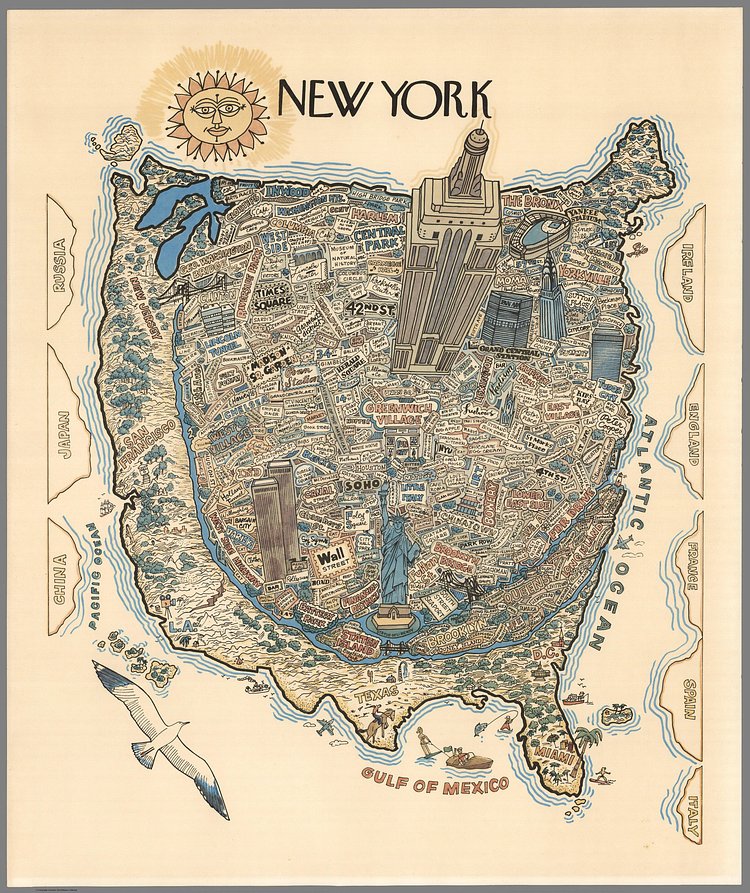
This amazing cartoon map pretty much sums up how most New Yorkers still see the City today, nearly five decades after it was originally drawn. Everything to the North of Westchester is Canada, everything South of Staten Island might as well be Florida. Anything West of the Hudson is corn up until San Francisco, and to the East, London is obviously the last stop on the L train.
via /r/MapPorn

Matt Coneybeare
Editor in Chief
Matt enjoys exploring the City's with his partner and son. He is an avid marathon runner, and spends most of his time eating, running, and working on cool stuff.
Something wrong with this post? Let us know!


