Photo:
Imgur
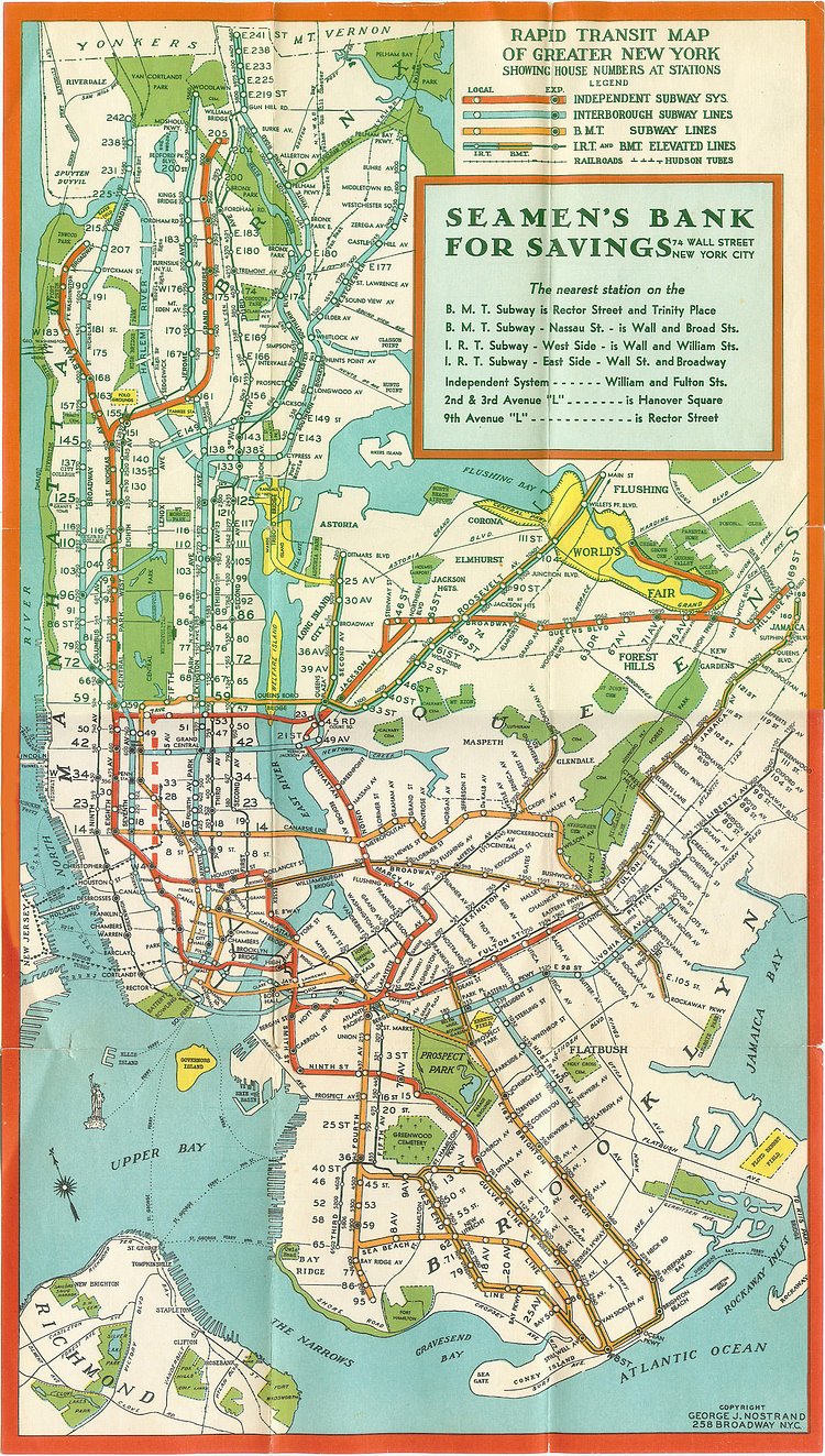
Take a look at the subway infrastructure present in 1939, between the BMT and IRT lines you can see the basis for most of the routes we use today. It's incredible to realize that the enormous subway system is actually shrunk from years past as there used to be elevated lines above most of Manhattan's avenues.
via r/nyc

Joshua Mu
Contributing Writer
When he is not attempting to hustle the hustlers of Central Park, Joshua enjoys exploring the depths of what New York has to offer. He one day hopes to pilot a drone without immediately crashing it.
Something wrong with this post? Let us know!


