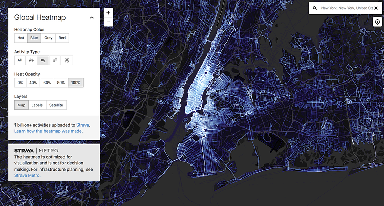
While there are many activity tracking Apps and devices out there, Strava has emerged from the pack as the industry leader, with millions of workouts tracked all around the globe daily. They recently analyzed all of this data an created a fascinating interactive Global Heatmap allowing you to see where most people run and bike, or do water and ski sports near you.
Our global heatmap is the largest, richest, and most beautiful dataset of its kind. It is a direct visualization of Strava’s global network of athletes. To give a sense of scale, the new heatmap consists of:
- 1 billion activities
- 3 trillion latitude/longitude points
- 13 trillion pixels rasterized
- 10 terabytes of raw input data
- A total distance of 27 billion km (17 billion miles)
- A total recorded activity duration of 200 thousand years
- 5% of all land on Earth covered by tiles
Check out the interactive map to play around with the data, and the accompanying article to learn how it was made.
via Strava

Matt Coneybeare
Editor in Chief
Matt enjoys exploring the City's with his partner and son. He is an avid marathon runner, and spends most of his time eating, running, and working on cool stuff.
Something wrong with this post? Let us know!


