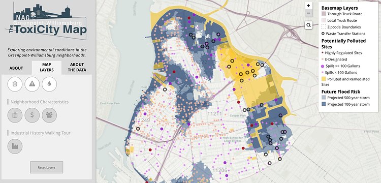
Brooklyn community advocacy group, Neighbors Allied For Good Growth (NAG) recently released a cool interactive map detailing toxic hotspots in Greenpoint and Williamsburg.
Data used to compile this map came from city, state and federal sources, guided by on-the-ground knowledge from local activists. Click through the data layers on the map to understand some neighborhood trends such as population density and asthma hospital visits, and locate some specific sites such as former NuHart Plastics factory and the Exxon oil spill.
The map has a lot of functionality, allowing the viewer to layer data such as flood risks and potentially polluted sites over neighborhood characteristics like median household income.
Check out NAG's website for more informative projects.

Joshua Mu
Contributing Writer
When he is not attempting to hustle the hustlers of Central Park, Joshua enjoys exploring the depths of what New York has to offer. He one day hopes to pilot a drone without immediately crashing it.
Something wrong with this post? Let us know!


