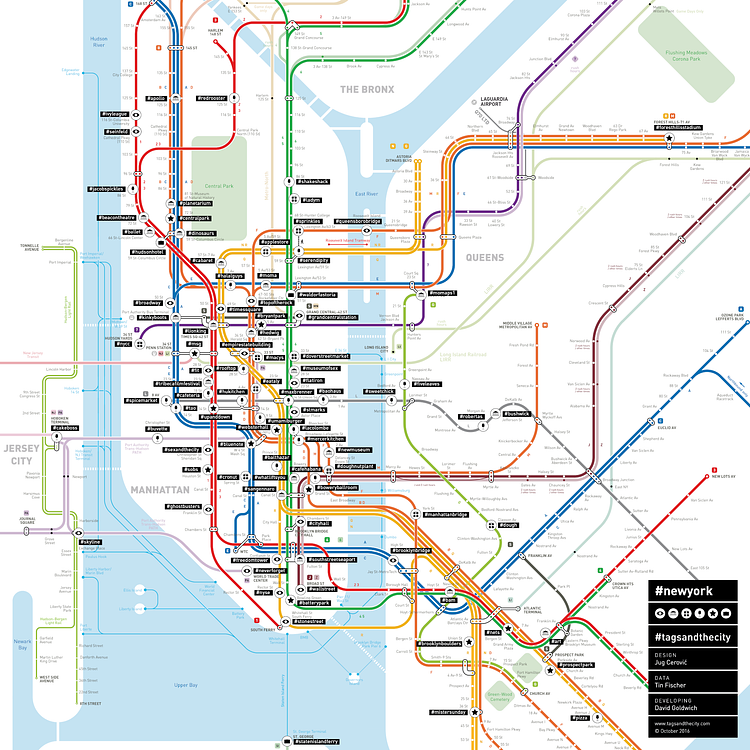
For an interesting project titled #tagsandthecity, the New York City subway map is reworked to replace the station names with the Instagram hashtags that are most frequently used around them. According to the map's creators:
We rename underground stations after the Instagram hashtag which is most popular around them. So you get a pretty good picture of how the city is photographed and what is going on where – especially for travelling, shopping, drinks and food. […] We grabbed geo-tagged photographs from 2014 from Instagram via it’s API (please note: we can no longer do that since Instagram restricted API access in July 2016). We only use data from 2014 because Instagram started clustering geo tags around 2014/2015, so precise localisation was no longer possible.
Aside from NYC, the team behind the project also created maps for Berlin, London, Paris and San Francisco Bay Area.